Friday, 16 February 2018

Some Natural Areas of Chatham-Kent, Part 6 (McKerrall Woods)

This natural area takes us inland, well away from the Lake St. Clair shoreline and associated wetlands of the last few posts. It is a little known natural area, and I feel confident that at least 99% of the residents of C-K have never even heard of it let alone visited it. In fact during all the years that I have been going to it, I have yet to see anyone else there except for the one time I led a hike to feature the display of spring wildflowers. The name of this place? McKerrall Woods.

This first image shows it relative to the north end of Chatham. The large Superstore/Walmart shopping area in north Chatham is visible in the lower left hand corner. Towards the upper right hand corner is an area marked with 'M'. This is the location of McKerrall Woods. So distance isn't a factor to explain why it is not known and seldom visited.
 This closer map shows the configuration, outlined by the blue line. The gravel road along the bottom of the photo is Darrell Line. At the bottom of the image is an 'X'. That is where the small parking lot is, just a kilometre or so east of DeGeest Line. What makes this site difficult to find is that in spite of there being a small parking lot, the woodlot is at least a couple of hundred metres away from the parking lot, and even though there is a sign in the parking lot, the white cedars that were planted along it quite a few years ago have grown up and completely hidden the sign. To access the woodlot, after parking in the small lot, one can walk through a red steel gate and along a grassy path and cedar hedge to the edge of the woods. There are no trails here, you just wander wherever you like.

This woodlot was given to the municipality many years ago. I don't know any of those details. However it is publicly owned and accessible. It is about 20 hectares (50 acres) in size and the mixed upland/lowland forest is in nice condition.
 Some parts of the woodlot have a fairly dense understorey, as shown in the next photo.
 Other parts are quite open.
 During late April and early May, there is a good diversity of spring wildflowers, some of which are shown below.
White Baneberry
Jack-in-the-pulpit
Squirrel Corn
Red Trillium
Long-spurred Violet
After the forest canopy is in full leaf, the wildflowers are usually on to the next stage of their lives, which is developing seed, and the forest floor is covered with greenery.
During the bird migration, a number of birds can be found, including migrating warblers. The site has not been heavily birded, as the modest number of species recorded for the site to date (45) would indicate. If it was birded more intensively, this number could likely be doubled. For example the next site I will be describing is a smaller woodlot, but has 109 species known, primarily because it is visited more often.
Cape May Warbler, a migrant
 Rose-breasted Grosbeak will be found as well, although probably do not nest here.
Birds typical of this size of woodlot include species such as Great Horned Owl, Red-tailed Hawk, various woodpecker species, one or two warblers, flycatchers, Baltimore Oriole, Cedar Waxwing, etc.
Baltimore Oriole
Cedar Waxwing
There is a good diversity of trees as well, all of which are fairly typical of the area. With the topography varying very little in this part of Ontario due to the outwash of the receding glaciers, the entire site is gently undulating, with lowland forest in the wettest areas, and upland forest in the higher drier areas. Therefore there is a mix of typical maple and oak species, along with American Beech, Sycamore, Black Cherry, Basswood, etc.

The lowland forest part does support a fairly healthy population of Poison Ivy. I usually wear rubber boots to minimize contact with it.
Typical lowland forest with shallow pools of water
Sycamore is not a common species, but is widespread. Looking at the lower part of the trunk, doesn't show anything that really stands out about it. The large tree on the right hand side of this next photo is a good sized Sycamore.
 If you look a little higher up the trunk, you may notice the bark looking quite mottled like either of the next two photos.

One of the reasons I go there several times a year is to enjoy the peace and quiet. Being so far off the road, and at times when farm machinery isn't very active, it can really be pleasantly quiet, especially when you have the place to yourself. On occasion you may hear cattle from a property nearby.

Another reason I enjoy this place is because there are a few impressively large trees, the older growth characteristics giving one a few hints of what the area might have looked like before settlement. Here are a few I've captured on digital film. This first one is an American Beech, and is slightly less than one metre in diameter. That makes it one of the largest diameter American Beech in the province!
American Beech
 This Bur Oak is a little more than a metre in diameter.
 This next one is a Swamp White Oak, and is a good size for the species.
 A really large individual is this Silver Maple, measuring 143 cm in diameter. Silver Maples grow quickly since they grow in wet sites, but don't live nearly as long as many other trees. However their rapid growth even in such a relatively short time can give them some impressive diameter.
McKerrall Woods is always a treat to explore. While the walking conditions can be a little wet in the spring, depending on the year, the late summer and fall period is very enjoyable, shuffling through the leaves or looking through the amazing golden colours.


Check it out.....I'm sure you will be glad you did!

Tuesday, 13 February 2018

Some Natural Areas of Chatham-Kent, Part 5 (Mitchell's Bay South)

This post features the Mitchell's Bay South Nature Trail. It is located between the south side of the village of Mitchell's Bay and Angler Line. The photo below has been turned 90 degrees, so that north is actually at the left hand side of the image. You can see a bit of Mitchell's Bay. The hard surface road at the right hand side of the image is Angler Line. The 'X' at either end of the blue line, which depicts the walking trail, represents the location of a small parking area. The 'B' marks the location of a boardwalk that goes out into the lake.


From the Angler Line parking lot, you will see two trail entrance signs.
 The trail has a fine textured gravel surface, perfect for walking or biking.
The trail is situated on top of a berm that was constructed decades ago, to protect the farmland from the fluctuating water levels of Lake St. Clair. Therefore looking east from the trail you will see all farmland, which is sometimes good for finding shorebirds such as Black-bellied Plovers and Ruddy Turnstones early in the season, especially if the land has just been worked up. On the west (lake) side of the trail, there is a canal as well as a mix of some woodland and wetland separating the trail from the lake.

The canal is an excellent vantage point to see things like turtles. On occasion I have seen more than two dozen Painted Turtles.
Painted Turtle
 There are other turtle species in the vicinity, although much more challenging to see. The next photo is of a Musk Turtle, a legislated species officially listed as 'Special Concern'. It is a small turtle that spends most of its time in the water, hence the mossy look to it which is actually algae growth from being in the water so much. I took this photo a short distance away from this trail, as it was crossing Angler Line going from one wetland to another.
 Herons are sometimes seen in the quiet water of the canal, such as this Green Heron which I watched hunting for frogs.

A small population of another 'Special Concern' species, Swamp Rose Mallow, can be found along the edge of the lake, and is best viewed from the boardwalk. It is most obvious in August and early September.


Great Egrets are often in the vicinity, either along the shallow water of the lake shore, or sometimes flying overhead.
 Raptors are often seen, depending on the season. Osprey don't nest in the area, but can sometimes be seen hunting for a fish to catch.
Osprey
 On other occasions, things like this Peregrine Falcon may be in the area watching for small birds to try and capture.
One bird species that is a highlight to find, and has been seen annually somewhere along the Lake St. Clair shoreline area for a couple of decades, is the Yellow-headed Blackbird. It is a western species that is very much at the eastern edge of its range here. A small colony has nested in the wetlands of the Mitchell's Bay vicinity for about the last decade. Sometimes their colony has been right along the road making for excellent viewing opportunities, but in the last 3 years they have been nesting in wetlands out in the lake. They can be seen mixed in with flocks of other blackbirds, foraging on lawns or in nearby fields.


Friday, 9 February 2018

Early February Finds

I'll get back to the series on Natural Areas of Chatham-Kent soon, but I want to get this more timely post made.

Birding in winter can be a challenge to find much diversity. Thank goodness for feeders! Recently I wandered around part of the former Dover Township west of Chatham to see what I could find. Some Snow Buntings were around, but not close enough. Some Horned Larks were a bit more willing to stay close enough to the road. They are early migrants, singing away already.
 This next photo shows the 'horns' a little better.
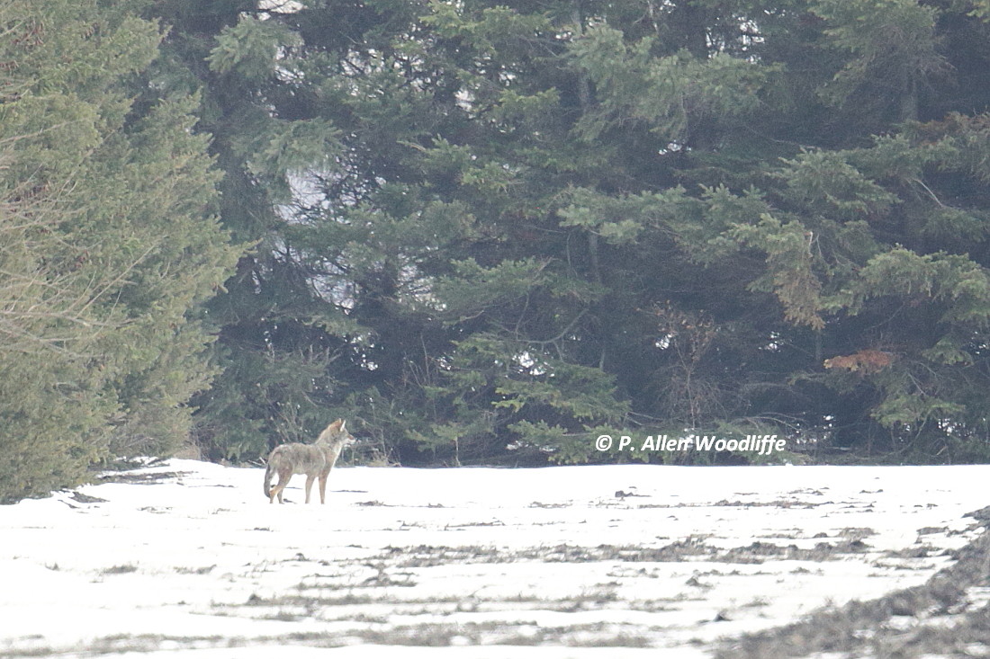
While driving slowly I noticed a canid off in the distance. It went through the end of the hedgerow, and stopped briefly due to something of interest off in the distance, and allowed me to get this photo.

The warm water outlet at the west end of Chatham had a few ducks, but of most interest was this female Belted Kingfisher.


A trip to Rondeau went well. Not surprisingly the greatest bird diversity was at the several feeders in the park. There were the usual things: Dark-eyed Juncos, Am Tree Sparrows, White-breasted Nuthatches, Blue Jays, Northern Cardinals, Red-bellied Woodpeckers, Downy Woodpeckers and such. Several Red-winged Blackbirds swooped in at one for a feed.

Downy Woodpecker


 I know....who bothers to photograph House Sparrows!

Away from the feeders there were a few things scattered about. I came across this White-throated Sparrow feeding along the side of the road.

This Hermit Thrush was the first of 2018 for me. It was hanging out in a brush pile at the pony barn.
Outside of the park I spent a fair bit of time driving back roads, hoping to come across a Northern Shrike, but it was not to be. On the way home one time, I checked for the ongoing Wilson's Snipe. It was there, but much farther back from the road, so only got a distant shot.


Tuesday, 6 February 2018

Some Natural Areas of Chatham-Kent, Part 4 (Mitchell's Bay North)

Moving a little south of the Bear Creek Unit of St. Clair NWA described in Natural Areas of C-K, Part 3, but still staying along the shoreline of Lake St. Clair, we come to the Mitchell's Bay North Lake Shore Nature Trail. It has only been open since the fall of 2015.

My first recollection of this site is a result of giving a colleague an aerial tour of the shoreline of the district in April of 1989. As we flew by, it really stood out. It was a private marsh, and to enhance it for waterfowl nesting, a 'cookie cutter' dredge was used to increase the openness and edge of the site. Note the black soil beyond the wetland. These are very rich soils that developed from the tallgrass prairie and/or wetland vegetation, depending on the lake levels, in historic times.
Fast forward to 2017, and the aerial view, compliments of Google, has the site looking like this.
It isn't the same scale as the previous photo, but I set it like this to show the length of the trail, as marked by the blue line, and also to show it relative to Mitchell's Bay and Bass Haven. Some of the squiggly lines depicting open water that were present in 1989 are still visible today. But some additional work has been done.

Parking is limited to where the 'X' is, as well as along one side of the gravel road.

There is a well marked, fine gravel trail marked in blue, which leads along some of the canals and in the wetland part, leads to a higher spot overlooking the part of the lake called Mitchell's Bay. The sides of the berms have been restored to tallgrass prairie, which would have been dominant here at the time of settlement, depending on the lake levels.


The abundant flowers of the tallgrass prairie are wonderful for attracting butterflies and other insects.
Clouded Sulphur

Little Wood Satyr
 Without trying too hard, I've recorded at least 15 species of butterflies to date. There are possibly another dozen that could occur. One of the rarest ones I've seen here is this next one, known as a Little Yellow.

As you can see from the map above, there are several channels through the site. With a few logs strategically placed, there are great opportunities to see water birds as well as reptiles and amphibians basking.
 Bullfrogs used to be extremely abundant in the marshes along this side of Lake St. Clair, and at times in the evening, their chorus could be almost deafening. Unfortunately in the last couple of decades or so, their numbers have dropped dramatically. There are still some to be found however.
Bullfrog

This next photo was taken from the very end of the gravel trail, and it is elevated a bit to give a better view. Off in the distance to the right, is the south end of the Walpole Island First Nation.
From here, you can often see various water birds, especially when the young have hatched and they are swimming about exploring their territory.
Common Gallinule

Pied-billed Grebe

Mute Swan
 Mute Swans can be quite abundant at times, and sometimes more than 100 are visible across the bay towards Walpole, especially in the late summer and early fall. This adult with the young, known as cygnets, were raised here. Unfortunately as photogenic as this species is, it is not native to North American, and therefore an undesirable species of natural areas to say the least. They are very aggressive towards native waterfowl, driving them away and interrupting the nesting activities of native species.

This next photo was opportunistic during the late fall of 2017, when I was able to photograph these two swans: a Mute Swan on the left and a Trumpeter Swan on the right.

Given that Mute Swans are quite aggressive, you would hardly ever see them tolerate being this close to a Tundra Swan, the sometimes abundant swan that migrates through in the spring and the fall. However Trumpeter Swans are about the same size as a Mute Swan, sometimes slightly larger, and they will not be scared off by the Mute. In fact at one point this Trumpeter Swan was seen aggressively chasing the Mute! Trumpeters are native species, that according to many authorities, used to breed in this area. (There are differing opinions on this, but I believe they were historically native to this area.) They were wiped out of the east back in the 1800s and early 1900s, and up until 2-3 decades ago, were limited in North America largely to some of the larger wetlands and lakes of the far west. But a reintroduction of the Trumpeter Swan was initiated in the 1970s in the north central part of Ontario. The population has gradually expanded elsewhere in southern Ontario, and we are now seeing a handful appearing in some of the larger wetlands here in Chatham-Kent. It used to be an extreme rarity to see them here at all; now it has become an annual event. Hopefully some will become permanent residents and re-establish a breeding population.

Other birds appear feeding in the area, or just passing through. There have been ~130 species of birds recorded along this trail to date, not bad since it has only been accessible for a short time, and birders hardly ever visit. In fact of all the times I have been at this natural area, I have only seen one or two other people there. It is definitely a great place to see lots of wildlife in a quiet setting.

Great Blue Herons do not nest here, but do so a short distance away at Walpole.

Northern Harriers, a.k.a. Marsh Hawks, probably nest in some of the larger wetlands along Lake St. Clair, and may be seen hunting over the cattails.
 On some occasions, the view across the wetland can be a terrific spot to capture an attractive sunset.


Next up will be the Mitchell's Bay South Lake Shore Trail.