Showing posts with label Thames River. Show all posts

Saturday, 1 July 2023

Forest, grassland and river highlights!

 Perhaps the three different habitats in the title are an odd mix, but the reality is those are what I have been exploring lately, and for good reason which hopefully will become apparent as this blog post unfolds.

Forests are fascinating at any time of year, but with the lush green growth, they are extra inspiring to me, especially on an overcast day with no wind. They have an atmosphere like nowhere else, and one feels a little overwhelmed in a good way, when one takes the time to see the multitude shades of green and gray, and tries to make sense of every little detail laid out before you. The forest has so many stories to share. Given that the main birding season is over, the trails are a bit quieter, so bird and insect song is subdued but noticeable. A small photo about 3" X 5" really doesn't do the area justice. If you click on the images, it will make them a bit larger, but still not quite like the real thing.You really have to get out and immerse yourself in the setting to appreciate what it has to offer, in my opinion.


These next two photos show Winterberry, not a common shrub, but a bit widespread in damp areas. It will have bright red berries in the fall, which are readily consumed by migrating warblers and thrushes.


 There are birds around, to be sure, such as this Acadian Flycatcher, which seems to be persistent along one stretch of the Tuliptree Trail but I am not sure it has found a mate....

 ...and Eastern Wood-Pewees are pretty reliably encountered.

House Wrens, too, can often be heard, and sometimes seen. This one was half of a pair of them investigating a cavity in a tree stub. The presumed male, shown here, seems to be half asleep while bubbling away!

A pair of Prothonotary Warblers can occasionally be cooperative along this trail. More on this species in a future post.

I have recently been out to a couple of grassland areas, in northeast Chatham-Kent and southeastern Lambton as part of a Grassland Bird Assessment project. Parts of them were at quite an early stage of growth, and didn't have a lot of grassland bird activity. No doubt the vegetation was much shorter when the grassland birds arrived, making it less desirable.
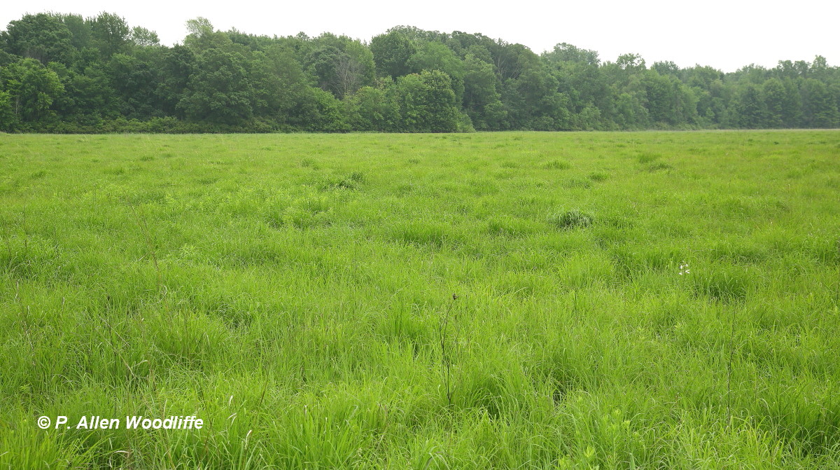
Other parts had some vegetation structure from 2022, and had more going for it, it seemed.
Bobolink was one of the target species, and there were a few around, but often partially hidden in the grass which made locking the focus on the bird difficult.....
...so I had to wait for them to be in flight, and in spite of their somewhat erratic flight, was able to capture a few photos.


Common Yellowthroats were fairly widespread.....
...and a few females popped into view from time to time.
There were a few butterflies flitting around, such as this Common Wood-Nymph. There were others, but I didn't want to get too distracted by them since birds were my main target.

I also spent some time at places where I could access either the Thames or the Sydenham rivers, sort of in preparation for an upcoming project entitled Natural Treasures of Chatham-Kent. More on that in a future post.

A shrub that was in fine flower on one occasion was Ninebark, shown in the next two photos.

These two rivers have an exceptional diversity of mussels, many of which are at risk, such as these next two species.
Deer Toe Mussel

Deer Toe Mussel

Pimpleback

Pimpleback
 It was interesting to note that of the first three species of mussel I photographed at one spot along the Thames, all three were considered Species At Risk! It just impressed upon me about the diversity of mussels that occur in these rivers, and how special they are.

Damselflies and dragonflies are also well represented.

Ebony Jewelwing

Calico Pennant
And a few butterflies were also present, including this Baltimore Checkerspot, not particularly rare, but not all that common either.


If you would like to subscribe, or unsubscribe, to Nature Nuggets, send an email to: prairietramper@gmail.com


Friday, 5 February 2021

Early February jaunts, before the real cold

 It definitely seems more like winter! I got out a couple of times before the forecast for the cold and snow was to arrive, looking for lingering things. The Stefina Line area southeast of Blenheim can be worthwhile, especially if a Wilson's Snipe shows up at its usual haunt in the winter. It hasn't yet, to my knowledge, but other things are around. Northern Harriers can be seen regularly floating over the grassy fields. They usually aren't very close, and with a busy background, are hard to get and keep in focus.


On one occasion as I approached the ditch where the snipe is often seen, I was surprised to see this adult Bald Eagle in a tree at the edge of a woodlot. I only had time for a couple of quick shots, and these were taken through the front window of the vehicle, so they aren't as crisp and clear as I would like. This is the first time I have ever seen a Bald Eagle anywhere near this spot. It makes one wonder if it is looking for a new nesting location, as the Ontario population generally is expanding, so it bears watching.

At another scrubby old field pasture type setting a bit farther north, I sat watching several dozen sparrows coming and going, all the while several raptors were on the hunt for something to eat. Most of the sparrows were House Sparrows, but there were several Am Tree Sparrows and upwards of a dozen White-crowned Sparrows mixed in. This young White-crown obliged me for a minute or so.

I took the opportunity to check out part of Rondeau. It was a nice sunny day, albeit a bit cold and with a brisk northerly wind. Clearly there were other people who had the same idea, as most of the parking lots had several vehicles. I chose to go out the west side of the South Point Trail (SPT), which is a nice walk through the forest and ends up at the lake. There were very few birds, but woodlands are normally fairly quiet at this time of year. Even looking out over the lake produced absolutely no birds in sight. But the shoreline landscape was worth the walk out. 


Lately it has been next to impossible to make one's way through the shrubby tangles and fallen trees along the shoreline. The former South Point Trail is now officially two trails, with one being SPT East and the other SPT West. With the buildup of ice piled along the shoreline, and the north winds which meant the waves weren't crashing on shore, I decided to tackle the challenging shoreline from the west side around to the east. It wasn't easy, but a whole lot easier than it would have been a month ago. Once I got to the east side, I continued up along that side of the SPT, then followed Harrison Trail north to Gardiner Ave and then back to where I had initially parked. It was a total of at least 8 km, and in all that distance, I only came across 6 people going the opposite direction, so physically distancing was easily done.

Upon returning to Chatham, I realized that the Thames River was almost totally frozen, so that made it an easy decision to take a side trip to the water treatment plant where it spewed warm water out into the river. Even in the coldest weather, there is usually an open spot varying in size depending on the intensity of the cold, and that makes it attractive for lingering waterfowl. This first photo, taken a couple of years ago, shows how small the open spot can be, but the waterfowl congregate in large numbers regardless. When they aren't resting on the ice, many can be seen in the water, waiting for a small fish to appear. The fish are likely also attracted to the warm water flow, so it serves the waterfowl well. It does seem a bit odd, however, to see Mallards, normally an eater of grain types of food or other vegetable matter, swallowing a fish!

Mallards are the most plentiful, with typically at least 100 birds. There are a few Am Black Ducks mixed in.

And usually there are a few singles of other species.

Common Goldeneye
This next photo shows the male Wood Duck, which was my primary target for this photo. It wasn't until a bit later that I noticed the duck to the right, which is a female Wood Duck. It always had its head tucked in, so wasn't immediately apparent from a distance.

An immature Bald Eagle flew through fairly quickly, as did a Red-Tailed Hawk, but I didn't get their photo. A Belted Kingfisher is often here, perched within easy sight of the water outlet, waiting for a small fish to appear. But I didn't see one on this visit.

As I was returning home, I had to wait for a stop light near a taller apartment building more or less overlooking the river, and where a Peregrine Falcon was seen regularly last year. The presence of ~150 Rock Pigeons in the immediate area is a readily available food source for this aerial predator, and although it had been reported on one occasion a few weeks ago, I had not encountered it yet. That changed today, as while I was waiting for the light to change, I glanced up at the top of the building and saw it perched on one of the tallest aerials. So I immediately changed plans and got myself located to a spot where I might get a photo. It wasn't close by any means. This first photo, taken with a lens combination at an equivalent of about 14 power binocular, was cropped to the equivalent of about 21X. 

And this is what it looked like cropped to about 110X!


Sunday, 25 February 2018

Thames River Flood in Chatham

Perhaps you have been deluged with photos of the recent flood of the lower reaches of the Thames River. Here are a few more.

The Thames River watershed is massive, draining approximately 5800 square kilometers. With all of the rain received in the watershed in the last few days, as well as the warm weather causing rapid melt of the higher than average snow pack, all that water has to go somewhere, and that somewhere is down through Chatham-Kent before the river empties into Lake St. Clair.

It has hit Thamesville and Chatham particularly hard. An interesting short video can be seen here.

I've checked out the flooding from several vantage points. One of the more accessible ones is the Third Street Bridge. This first shot looks towards Thames Street, which is totally flooded, and you can see well off to the right where the river is supposed to be. It has overflowed the banks by at least 100 metres at this point, it seems. (Click on any of the photos to get a larger view).


Towards Thames St with the flooded parking lot on the right
 This next shot shows the entrance to Thames St, just south of Harvey's (which was open the entire time, and sometimes quite busy, too).
 There was no one lining up to pay for non-existent parking!
 The bridge abutments managed to snag some debris, causing a slight damming effect.

Looking straight down Thames St

Looking to the south side of the river, from the Third St bridge
 This next photo is looking straight upstream, towards the Fifth St Bridge, which is under construction and barely above the water level.

 This next shot shows the entrance to the promenade on the south side of the river.

This next photo is looking downstream from the Third St Bridge. The tallest building on the left is the Civic Centre, and the complex of buildings on the right is the hospital. Fortunately the hospital side is a little higher so less threatened than the opposite side.

These next three photos were taken from the waterfront at the Civic Centre. The first one shows part of the former YMCA parking lot, with the hospital in the background across the river.

This one is directly in front of the Civic Centre, with a small building and a stairway in the water. The actual Civic Centre grounds did not appear affected, although there was some water in the Centre's closed off underground parking area.
 Across the river between the Civic Centre and the Third St. Bridge are some houses that normally would have a nice waterfront setting. Note the 'above ground' swimming pool almost completely underwater.

These next two photos were taken from the Lower Thames Valley Conservation Authority headquarters. The first photo looks towards the Fifth St Bridge which is under construction. Note the top of the picnic table. It wasn't apparent whether it was floating or not.

Next is from the waterfront deck of the LTVCA HQ, looking across to Tecumseh Park. Most of the park is high enough so as not to be affected by the current water level, although the walkway along the water's edge is completely submerged. A street on the left goes to the water's edge, but is blocked off.

A bit farther upstream is Thames Grove Conservation Area. There is a boat launch, a picnic area and walking trail and lots of open space. It is where the tremendously popular War of 1812 Re-enactment event took place in the fall for quite a few years. There is housing that backs right on to the CA. Now much of the CA is completely underwater and has also affected back yards. I'm not sure how basements fared, but there were some that had hoses out the basement window which had been pumping out water!

In this first photo, note the top of a large picnic shelter through the trees, barely sticking above the water.
 The water came close to some houses.
 Many back yards were at least partially submerged, and this photo was taken a few hours after the water had peaked.
 A couple of Mallards were using some debris to take a rest.
With winter winding down and spring just a few weeks away, hopefully this is the worst we will see!